Brodie Swisher
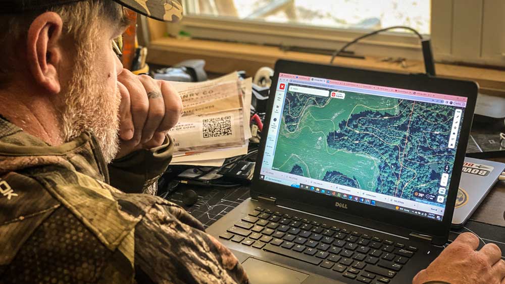
With all the advancements in modern technology for hunters these days, few have proven to be as beneficial as the smartphone hunting app, onX Hunt. This simple, yet sophisticated, tool is one that’ll change the way you scout and hunt for whitetail deer. It’s truly game-changing when it comes to how you handle business in the deer woods.
It’s the tool every hunter should have, but one I secretly hope my local hunters haven’t discovered yet. The app can do far more than we have time to discuss in one simple article, so we’ll focus specifically on how to use it in the whitetail woods right now. Here’s a look at how to use onX Hunt to map out your rut hunting plans in the weeks ahead.
Chart and Plan Treestand Sets for the Rut
onX allows you to plan out your rut plans days, and even weeks, in advance by referencing dropped pins you have in place for the various treestand locations, and potential locations, you’ve added to your map. You’ve likely got all your business and family meetings lined out for the next couple weeks on the calendar. You know where you need to be and when you need to be there. Your treestand plans should be no different.
The app allows you to cross reference your saved treestand locations with wind directions so you’ll know what works best through the morning, mid-day, and afternoon hunts. Get your hunting plans lined out to be more efficient, and eliminate all the guesswork and pre-dawn scramble that comes when you don’t have a plan in place.
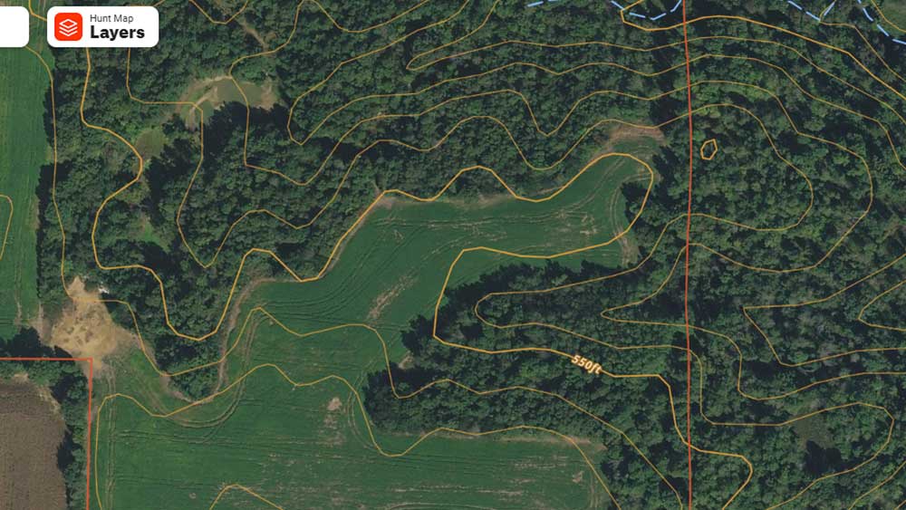
Hone In On Buck Travel Corridors
onX helps you quickly and easily locate bottlenecks, pinch points, terrain feature changes, edge cover and so much more. These are the connectors you can easily discover from the app, all without ever putting boots on the ground. These are also the connectors that bucks will travel as they cruise the property looking for a receptive doe.
I can’t count the number of times I’ve looked at an aerial photo of a property during the rut and said, “I bet there are scrapes all over that pinch point.” Sure enough, once I put boots on the ground, I confirmed my suspicion. Bucks were in fact using these travel routes and left plenty of sign to show how they were traveling through the area. This is one of the greatest advantages onX provides to hunters as they attempt to get dialed in on the hottest travel routes of the local bucks during the rut.
Plan Around the Wind
Deer hunters know wind direction is a big deal when it comes to planning a hunt. But even more than going undetected during the rut, knowing the wind direction can greatly benefit the way you map out your plan of attack. Think about it. Bucks will use the wind to their advantage as they travel the landscape searching the thickets and bedding areas for does. Cruising up the downwind edge of these thickets allows them to quickly and efficiently check for a doe in estrus.
That’s why the onX Wind Calendar tool is so beneficial. You can map out your plans, stand locations, entry and exits, and the route you suspect a buck will take as he conducts his downwind cruising efforts for does. This feature provides projected wind speed and direction at sunrise, midday, and sunset for the week ahead. It’s a great tool to help you line out your rut strategy and eliminate the surprises and guesswork.
Map Out the Freshest Rut Sign
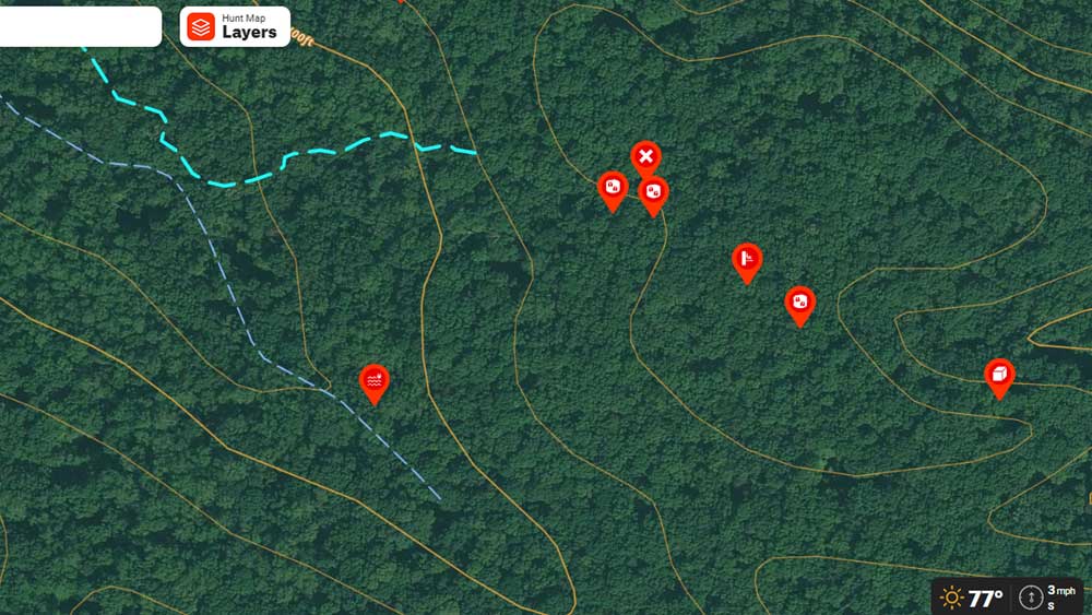
Tracking the freshest sign helps you keep tabs on what’s taking place on the properties you hunt. onX makes this super easy with the ability to add waypoints for rubs, scrapes, bedding areas, food sources, trail crossings, scat, tracks, water sources, and more.
Why is it important to drop these waypoints on your map? As you map out buck sign during the rut, you’ll quickly begin to notice how deer naturally move about the landscape. You’ll see the patterns that once went unnoticed when you have pins dropped on these locations. You’ll quickly begin to put the pieces of the puzzle together when you discover and map out the relationship of food sources, water holes, bedding areas, escape cover and the subtle travel routes that connect them all together. It’s a big advantage that’ll pay off for many seasons to come.
Talk With Local Landowners
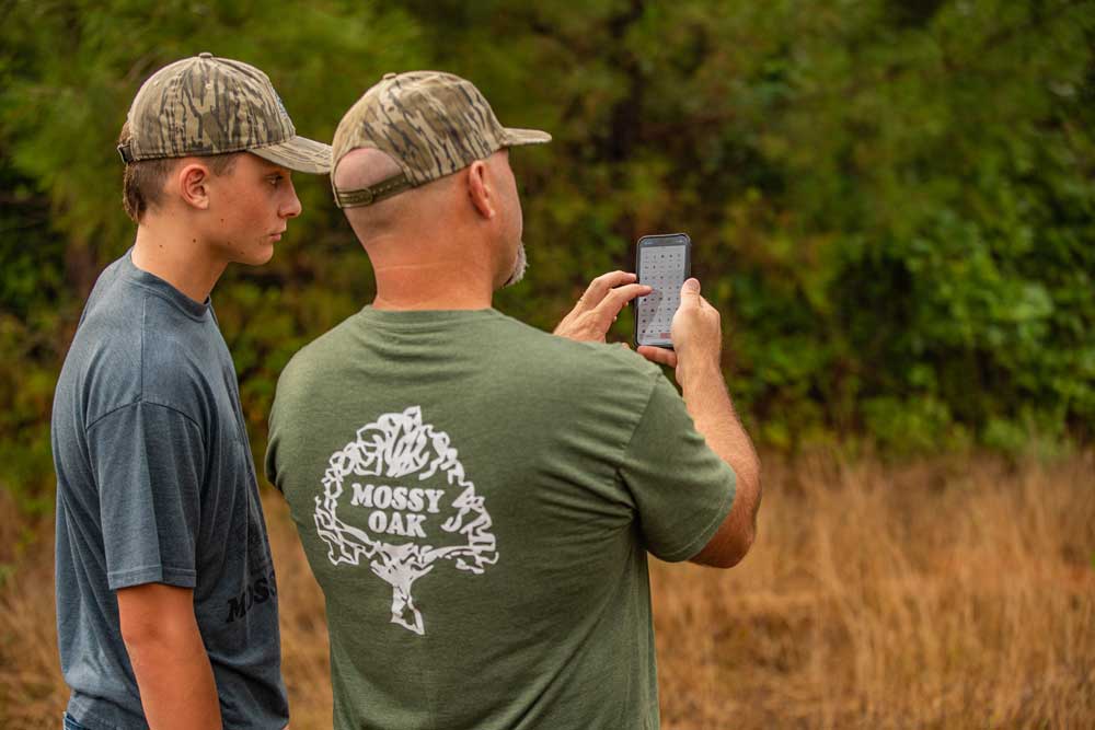
Sharing Property Information Using OnX
A lot of hunters are scared to death of the idea of knocking on the door of a stranger. They just won’t do it. And it’s a mistake. Knowing the local landowners is a huge advantage during the rut. You can bet they’ve seen the deer you’re after. And despite their tendency to exaggerate the size of the buck from time to time, they can tell you exactly when and where they saw it. These are simple clues to help you map out a game plan.
So whether you’re seeking permission to hunt, or simply building relationships for the future, knowing who’s who in the neighborhood is a big advantage. And onX makes knowing the locals easier than ever with the property owner info featured in the app. You can quickly figure out who owns the property, his wife’s name, how many acres they own, and their address. It’s the perfect tool to line you out for a front-door conversation about the local deer population.
Wrapping Up
Nothing can ever replace the vast knowledge and wisdom that comes with boots-on-the-ground woodsman skills. But the onX Hunt app on the smartphone in your pocket is undoubtedly the greatest tool to help expedite the process. Every hunter should have this tool loaded in his or her phone. There’s no better way to map out your rut hunting plans this season.
FOR 20% OFF YOUR FIRST ONX HUNT SUBSCRIPTION, USE CODE “MOSSYOAK” AT CHECKOUT.