Heath Wood
Having spent much of my life living in a small rural area in southern Missouri, I have become accustomed to the small-town perks that can quickly be taken for granted.
In the famous country song, “I’m From The Country” by Tracy Byrd, “everybody knows everybody, and everyone calls you friend.” Those words ring true for the small-town perks that I previously mentioned. One of my favorite benefits over the past 30-plus years of hunting in a small town is driving down a road and seeing the wild game or potentially good hunting areas and realizing that I know the property owner. In knowing the owner, I can make a few calls and get permission to hunt the area.
Getting permission to hunt a property is not as easy for someone who does not have the luxury of living in a rural area.
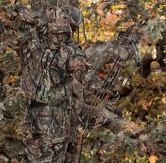
When predator hunting, you often wonder how to increase your coyote harvest number while becoming a better hunter. I have learned that the more places you have to hunt, the better quality hunting you will have, and you are less likely to over-pressure coyotes.
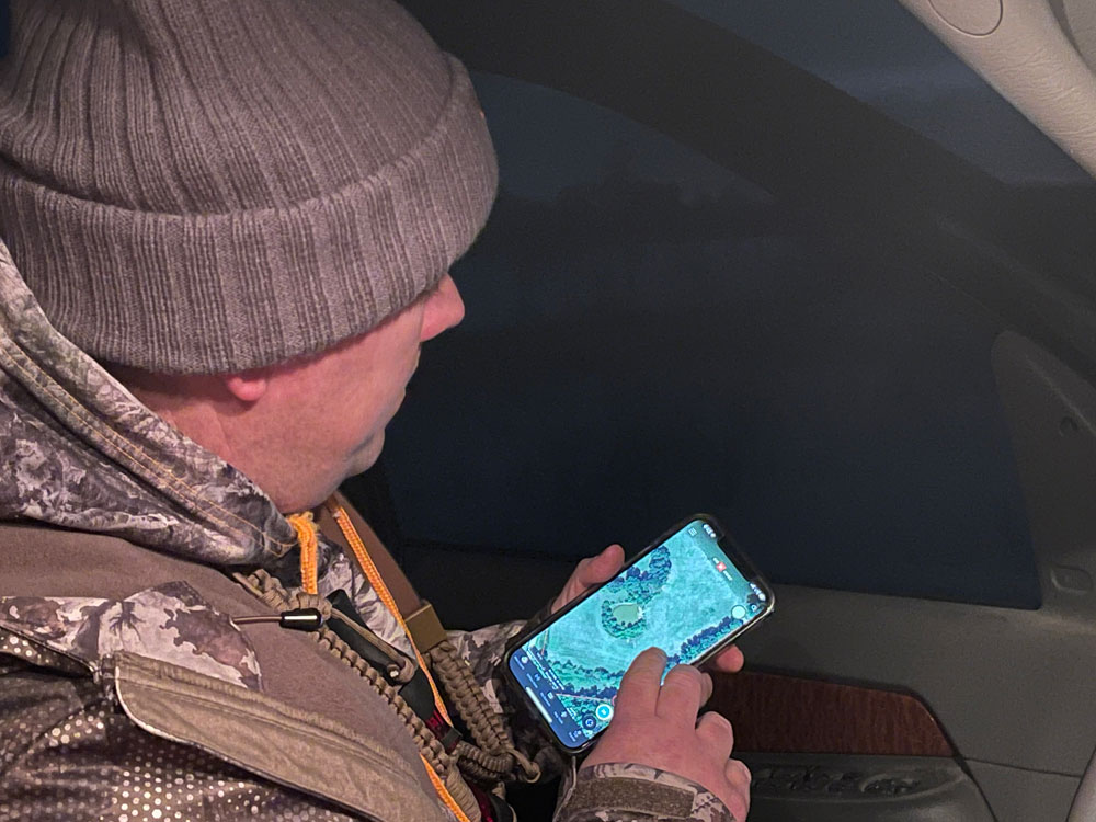
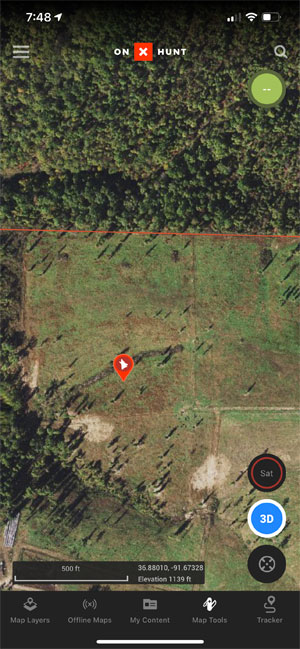
I am always in search of another property to call coyotes. I try to make a habit of asking farmers and landowners if they have coyote problems and if they need help controlling them. Another way to seek more hunting areas is by using a hunting maps app such as OnX to see an overhead satellite image of the land, how it looks, then seek out the landowner to gain permission.
 Gaining Permission To Hunt
 Gaining Permission To Hunt
One of my favorite features of OnX Maps is seeing who owns the land, where the boundaries are, and if the land looks good to call coyotes. I like this feature because, being from a rural area, I most likely know who the landowner is. However, if not, one can see the landowner on the On X Map and then look them up on the internet, in a phone book, on social media, or whatever need to gain contact with the individual to seek out hunting permission.
Over the years, I have earned friends and gained access to more hunting opportunities by seeking out landowners. Once you have permission and respectfully hunt their property, they will pass your name to their friends or those seeking help controlling predators because of wildlife management or livestock. Before you know it, you then have multiple outlets to call coyotes throughout the entire year, giving you a more substantial chance of success.
In the past, I would have obtained a plot map from our local county courthouses. A plot map was just that, a map of the area with a list of landowners. I would flip through the pages and try to find areas that I wanted to hunt, and then I would seek out permission.
Plot maps are becoming a thing of the past due to the simplicity and benefits of having an app like OnX.
Hunting private land is by far my favorite kind of hunting. However, some hunters do not have access to private land because of their area or the constant growth of private hunting leases and fewer access opportunities. When the private land is hard to find, hunters revert to finding nearby public land that offers the same hunting quality. And don’t get me wrong, there are many great opportunities and quality hunting on public lands.
Finding public land boundaries is another excellent feature that can be used when accessing the OnX Maps on your mobile device.
Scouting
Finding accessible ways to gain access to more hunting property is only a fraction of the advantages of using a hunting map app while predator hunting.
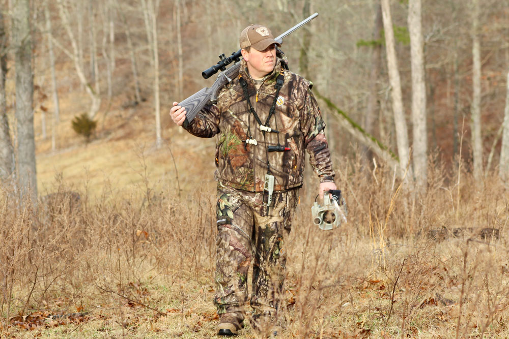
Another important tactic that I have learned while predator hunting is to scout the areas where you will call but do the scouting days before the actual hunt. One of the most significant factors that lead to an unsuccessful hunt while calling is simply due to it being a poorly populated area to hunt. Although it may look good in our eyes as we drive by or make a quick walk-through of the land, it is only a good area to hunt if coyotes live in that area.
The only way to ensure an area will produce coyotes is by scouting. I have recently raised the bar on my scouting regimens because of using OnX Maps and its many features.
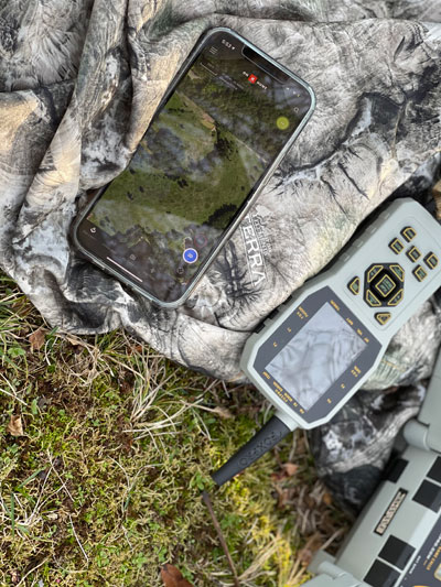
The first feature is satellite imagery or topo lines, used to see how the land lies in the area you will be hunting. Knowing the higher points of the land will allow for better setups when calling. Knowing the terrain and seeing trails, roads, and access points also gives you a game plan for entering and exiting an area when hunting. For example, if you find one particular field that coyotes have been close to and look like an excellent place to make a setup, you can look at the OnX Map and see the best way to approach the area without being seen. Not being seen while entering gives you a better chance of making a successful calling stand when hunting.
The next feature is that of creating waypoints. By marking an area, one can remember where they encountered coyotes, heard coyotes howling, their game camera locations, and even marking an area where you previously harvested predators. It also can add a photo with your waypoint to help you recall what hunt took place and what predator was harvested.
By marking these areas, it gives you a visual when looking at the map to see where the most activity is occurring. If you mark the areas where coyotes have been located each time, it doesn’t take long to see where the best spots for hunting will be by seeing a glob of marked waypoints in one particular area.
Another great benefit to using OnX as a scouting tool is looking an area over without actually leaving human scent in the area or taking the risk of being seen by coyotes. Less pressured coyotes are more likely to respond to a call when hunting.
 Planning Future Hunts
 Planning Future Hunts
After all the scouting is done, it is time to establish a game plan to go into the area and make a calling stand. Creating a game plan is another excellent feature of the OnX Maps that I feel can make you a better predator hunter. You can see the weather forecast for the area you will be hunting on the app, including wind directions.
I have always heard many top predator hunters say that you need to make better quality stands to achieve more success. To make a quality stand, you need to have an area where you positively know there are coyotes. That’s not all; you also need to get to your desired calling destination without being seen, have the wind direction in your favor, and sit where you can see coyotes approaching the call.
If one takes a mental checklist and checks off the things needed to make a quality stand before hunting, they will see the advantages and why using a hunting map app can benefit. Every step to this planned success can be achieved with the aid of the OnX Maps app.
Technology is constantly advancing and giving predator hunters the upper hand. From obtaining plot maps at the county courthouse to having almost any area mapped out at the touch of a button is a true win for predator hunters.
Download now from your app store and Hunt Smart.
For a limited time, onX Maps is offering a 20% discount code only for Mossy Oak’s fans toward the purchase of its revolutionary GPS mapping tool designed specifically for hunters. Go to onxmaps.com and use the promo code, “mossyoak” to receive 20% off the normal price of onX’s Premium or Elite memberships.