Andrew Walters | Originally published in GameKeepers: Farming for Wildlife Magazine. To subscribe, click here.
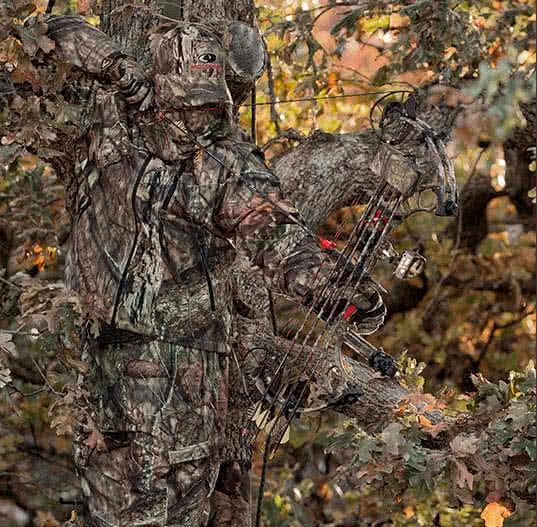
The buck slipped past my stand catching me completely flat-footed. Ironically, the previous year I had spotted another mature buck using the edge of a fallow field and a swamp as a means of travel. I missed my opportunity then, but vowed it wouldn’t be repeated. Fast forward one year and it was about to happen…again. As luck would have it, the hot doe he was trailing circled around and I connected on a second opportunity. However…not in the way I would have liked. The shot was too far back. The buck crashed off into the swamp fatally wounded.
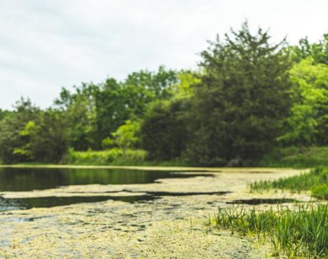
I managed to follow the blood trail until his death march began to merge into inches of muddy water. I soon became engulfed by darkness and lost the trail. Marking my spot and backing out, I made a game plan of how to pick up the trail the next day.
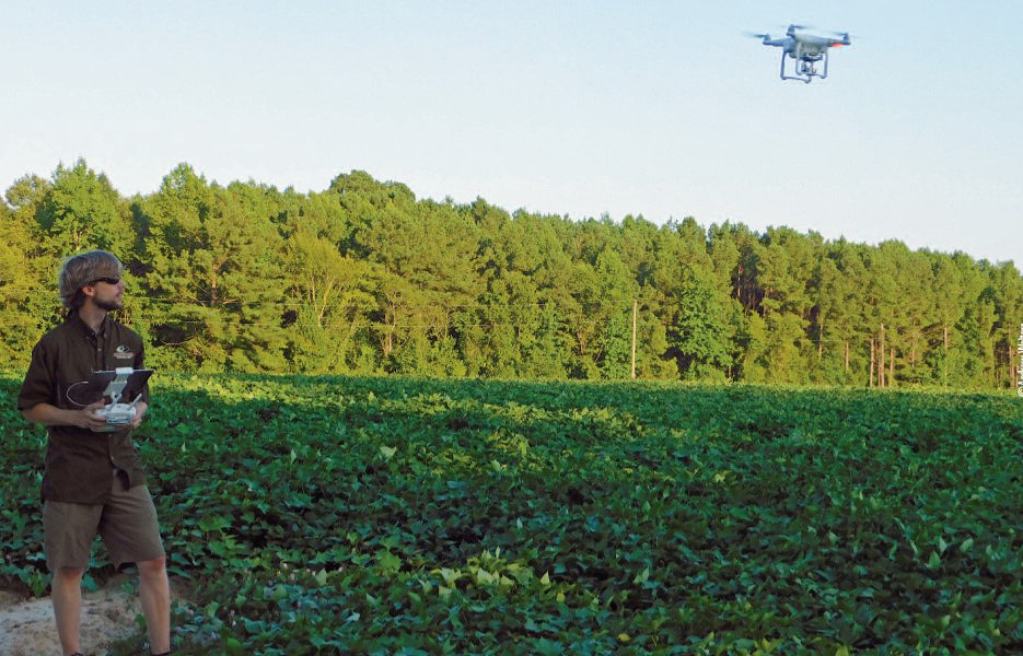
At 7:00 AM the following morning, I launched a UAV (unmanned aerial vehicle) or commonly known as a “drone,” into the sky and decided to search the edges of the swamp, guessing the deer probably expired in the dense vegetation along the edge of the water. As the aircraft was transmitting a view to my tablet, I noticed a speck of white along the water’s edge. I descended the aircraft until a half submerged deer appeared in the water.
After mentally marking his deathbed, I began trekking towards the deer. It was tough work retrieving the buck from the swamp’s black waters, but I simplified the trailing process significantly.
Before I go any further, I would like to note that using UAVs for the purpose of harvesting game breaches every element of what I believe is fair chase. However, as gamekeepers, it’s our responsibility to exhaust every legal resource available to recover wounded game. Also, I should clarify there is absolutely no substitute for boots-on-the-ground scouting or trailing, but there are times when having an aerial advantage works big-time in your favor.
Real World Applications of UAVs
The popularity of unmanned aerial vehicles has skyrocketed and while they seem complicated and intimidating from the outside, you can learn how to safely operate one in under an hour. From the local teenager down the road to the local wildlife biologist, UAVs have made their presence known and their applications are more widespread than you may think.
these UAVs are a sophisticated gamekeeper’s tool. With a
fail-safe function they can be configured to automatically fly
and come back to land at its take-off position if connection
to the transmitter is lost. Many will also automatically
compensate for a slight wind.
For example, not many people would connect the benefits of real estate agencies using a UAV. However, the views provided from these small aircrafts are so unique that many sellers ask to have aerial photographs in the marketing when selling their property. Even on a larger scale, across the world poachers targeting endangered species, especially those for their ivory tusks, are keeping an “eye in the sky” as drones patrol wildlife sanctuaries. Even some insurance companies have begun using them to view and evaluate crop damage after severe storms on large acreage operations.
As gamekeepers, there are many uses for UAVs. From monitoring food plots, to searching for wounded game, to simply gaining a different perspective on your property, there is much to be learned from these small aircrafts.
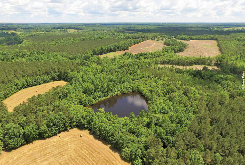
I have found them to be most helpful when searching for funnels and pinch points. These bottlenecks are easily observed from a drone. Initially, I would search for these bottlenecks by studying digital maps online. However, creeks flood, timberlands are harvested, food plot and cash crops are rotated and the successional stage of vegetative growth occurs.
Many times I believe I have found a perfect area (or so I thought), only to situate a treestand to find the “on-the-ground conditions” have changed drastically in the short time between then and when the online imagery had updated. I still use high definition maps as a primary source for locating stand sites, but I now fly over them as well to ensure the area is a good fit for what I need — obviously if the tree canopy permits visibility.
Keeping tabs on current food plot conditions is another plus to using UAVs. While not all surveillance can be aerial, there is a lot to be said for hovering a drone 10 feet above the ground and seeing how things are progressing. While the buzz of a small aircraft may alarm game in close proximity, I honestly don’t believe it has any long term effects on wildlife when used in moderation.
The lack of residual scent left behind is also a huge plus. Areas where hinge cuts have been conducted also provide a use for UAVs. The newly released canopy allows sunlight to penetrate to the forest floor, greatly increasing the production of forbs and grasses. The new growth can be easily identified when hovering over an area of habitat improvement. Having the ability to monitor your habitat management endeavors without contaminating the area with human scent or noise is incredibly beneficial.
There is much to be learned from flying a UAV over a stand of timber as well. The winter months are great time for seeing the amount of evergreen trees in relationship to hardwood trees as the presence of foliage is a key indicator of the type of timber on a property. Even the presence of disease or blight can be distinguishable from aerial photos and many foresters have begun using UAVs. It can also highlight areas such as pockets of hardwoods, dense bedding areas not visible on maps, and creek bottoms.
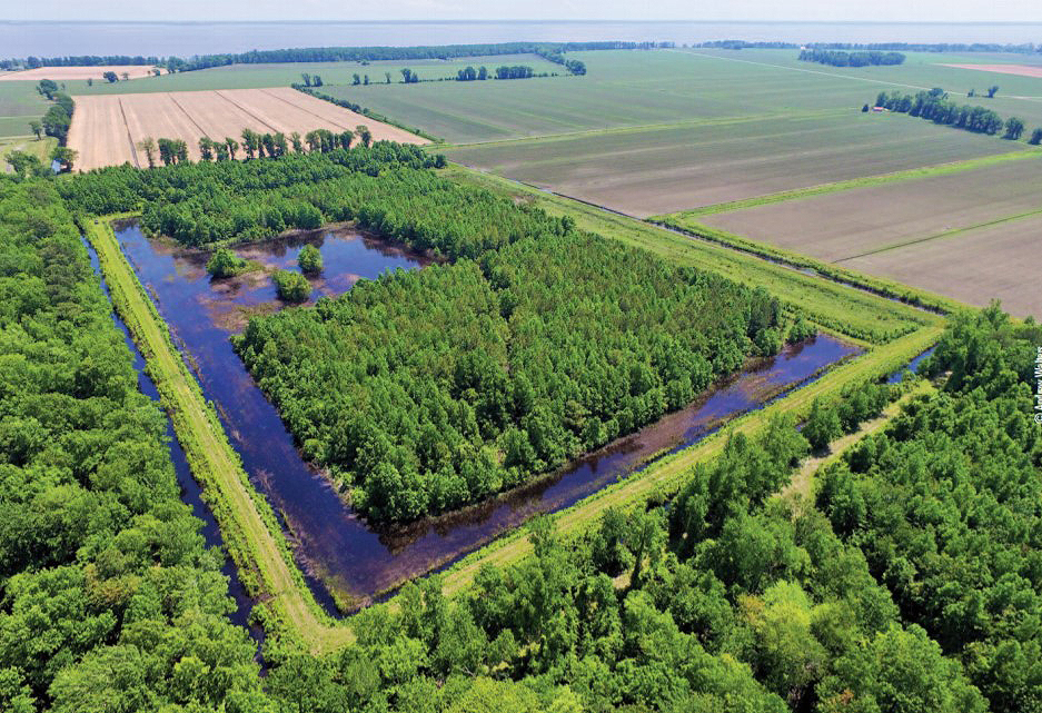
Not all terrain types have to be timbered though. Water drainages on large tracts of farmland can be monitored as well as water levels in waterfowl impoundments, especially if in remote or difficult to access areas.
Using Unmanned Aerial Vehicles In The Field
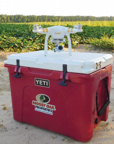
When it comes to launching a drone, the internal compass calibrates to ensure it sets a home point. A home point is where the aircraft will return to if the signal is lost or the battery gets too low. Most UAVs cannot be launched around metal objects or flown safety in areas with a high magnetic interference. The UAV also needs to be launched off of a solid platform. For this reason I like to use the hard top of my cooler. The top is just wide enough to provide a stable platform, tall enough to be above vegetation that can tangle in the props, and the lack of metal ensures a positive calibration.
Despite the fact you are viewing what the drone is seeing via tablet or smart phone device, you are supposed to keep your UAV within eyesight. This can be tricky because depending on the terrain, the aircraft may be able to fly much further than your line of sight will allow especially if you’re around tall brush or trees.
The wind conditions can also affect the UAVs mobility and response signal from the remote controller. The height in which a UAV can be flown is also limited. Most models have factory presets that stop the aircraft at 400 feet. While the higher-the-better may sound good in theory, it’s actually best to fly at around 80-100 feet. This allows you to miss the canopy of most tree lines, providing a higher-than-average perspective, but still ensuring clarity and the ability to view distinct characteristics on the ground.
I have a hard case backpack that my UAV easily fits into. The case has holders for extra props, a few spare batteries, and various other tools such as lens cleaning cloths and extra SD cards. Even if you forego the back pack, make sure to get a hard sided case. The ability to easily and safely pack the aircraft on an ATV or the back of a UTV is incredibly convenient and a great way to protect your investment.
Choosing a UAV Model
There is no substitute for research. There are dozens of models of UAVs to choose from and various manufacturers. A simple online search can provide a wealth of information. Many manufacturers have numerous models of the same UAV and each model features something the other doesn’t. The features vary from extended flight ranges, to higher quality cameras, and even autonomous flight modes.
Some UAVs have built in cameras and other models allow small cameras to be attached. Manufacturers that receive positive online reviews from the general public are a great place to start. Offering technical assistance and extended warranties is also a plus.
It is important to understand what a particular aircraft is able to do before purchasing. While it is highly unlikely a gamekeeper would need a UAV model suitable for cinematic productions, a reliable model that operates in isolated areas is a must. For example, the highest quality camera is great for photography, but it may not be worth the extra cost to everyone. The extended range option is also applicable here. Not all of the capabilities offered are necessary as everyone will use their device differently.
Debunking Myths

Crashing a drone is harder to do than most believe. Losing a drone is almost impossible. What’s the difference? Most UAVs have launch assist and return-to-home capabilities. This means the UAV will, when commanded, launch itself into the air or land itself. You can override the controls at any time in between to fly manually. You can also program waypoints, or areas of interest you wish the aircraft to fly over. In this instance, the UAV will autonomously fly to these areas in an auto pilot mode (this is great for searching for wounded game).
If signal loss occurs the aircraft will return to the home point where you launched it. The same applies if the battery begins to lose power. Most UAVs are able to limit the propulsions of the props to ensure the battery has enough juice to get it home. This is why a positive calibration when launching is necessary. As incredible as all of that is, it doesn’t mean a thing if you fly it into a powerline or a large oak tree. Practice is a key.
Lastly, keep in mind that those who oppose our views on hunting will use every bit of firepower they can against us. That’s why UAVs should never be used for hunting purposes or in the pursuit of game and the ethical practices of fair chase must always be followed. Always abide by all state and federal laws when possessing or using a UAV. As gamekeepers we should set a precedent for all who enjoy the outdoors and the outdoor lifestyle.
There is no doubt technology has its place in the world of wildlife and habitat management. While UAVs may not be on every gamekeepers Christmas list, there are plenty of ways you can step up your management game up by using one. If buying a drone and learning how to operate one seems daunting, check around. Having the ability to gain a unique perspective of things is never a bad idea. You’ll be glad you did!